With more than twenty years of experience running treks around Kathmandu, we know there is much more to explore than the usual trails.
Trekking near Kathmandu is easier than many travellers expect. You do not need to travel far to find forests, villages, mountain views, and quiet trails.
Some hikes take only a few hours. Others can take several days and lead deep into the mountains. The right trek depends on your time, fitness, interests, and the kind of experience you want.
For a short hike, Nagarkot, Dhulikhel, Shivapuri, Champadevi, and Phulchowki are excellent choices. Chisapani is a good option if you want to spend a night outside the city.
For a longer adventure, Langtang Valley and Gosaikunda offer a deeper Himalayan experience
Some take you through forests. Others pass through villages, farmland, temples, monasteries, and mountain landscapes. The following are some of the best treks and hikes near Kathmandu, with options for different levels of time and experience.
The Best Day Hikes Near Kathmandu
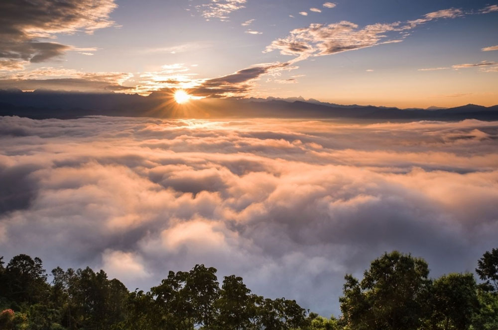
You do not need several days to enjoy trekking around Kathmandu. Several good trails can be reached within a short drive from the city. They offer forests, villages, temples, mountain views, and fresh air.
Here are some of the best day hikes near Kathmandu.
Nagarkot: Sunrise and Mountain Views
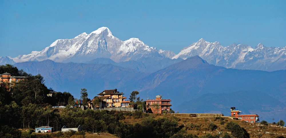
Nagarkot is about 32 kilometres east of Kathmandu and sits at around 2,175 metres.
It is best known for sunrise views across the Himalayan range. On clear mornings, the mountains can stretch across the northern horizon. With views towards the Langtang range and other Himalayan peaks.
But Nagarkot is more than a viewpoint.
What Is the Nagarkot Hike?
The Nagarkot hike is a countryside walk around the hills and villages surrounding the main town.
There is no single fixed trail. The route can be adjusted according to how long you want to walk, your fitness, and the weather.
A shorter walk can take a few hours around Nagarkot, while a longer route can continue towards nearby villages and eventually Dhulikhel.
This makes Nagarkot one of the more flexible hiking options from Kathmandu.
You can leave Kathmandu in the morning, spend several hours walking through the countryside, and return to the city on the same day.
What Does the Hike Actually Look Like?
Once you move away from the main viewpoint and road, the landscape becomes much quieter.
The trails pass through pine and mixed forests, farmland, small settlements, and traditional village paths.
You may see farmers working in their fields, livestock being moved between settlements, and local people walking between villages.
Some sections follow quiet roads, while others use narrow footpaths through fields and forest.
The walking is generally easy to moderate, with some gradual climbs and descents.
The experience is more about exploring the countryside at a comfortable pace. It is not completing a demanding mountain climb.
Who Is Nagarkot Suitable For?
Nagarkot works well for travellers who want their first introduction to hiking in Nepal without committing to a long trek.
It is suitable for families, older travellers who are comfortable walking, couples, and travellers with limited time in Kathmandu.
You do not need previous trekking experience for the shorter routes.
What Makes Nagarkot Different?
The combination of mountain views and everyday village life is what makes Nagarkot different from simply visiting a viewpoint.
You can start the day looking towards the Himalayas. Later, spend several hours walking through farmland, forest, and local settlements.
The area also has a strong mix of Tamang and Newar cultural influences. Nagarkot has traditional villages and agricultural landscapes surrounding the hilltop.
For us, the best way to experience Nagarkot is not to stop at the viewpoint and leave. A local guide can take you onto quieter trails, explain the villages and landscape, and adjust the walk around your time and interests.
For a short countryside hike with mountain views close to Kathmandu, Nagarkot is one of the most practical choices.
Book a Nagarkot Day Hike or explore longer Nagarkot trekking options.
Dhulikhel: Mountain Views and Local Life
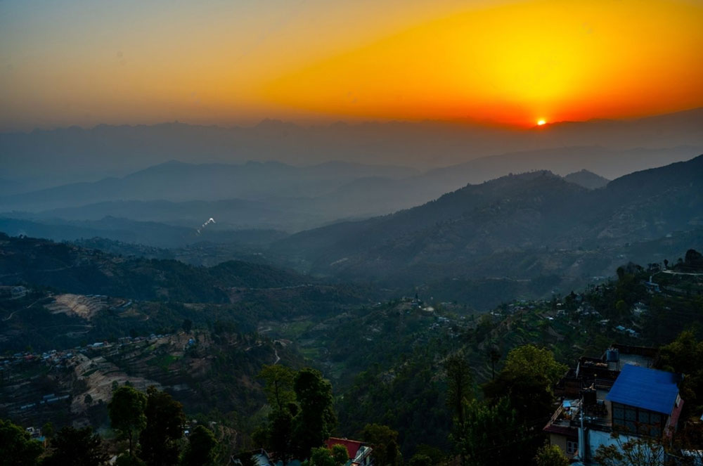
Dhulikhel is one of the best places near Kathmandu for a hike that combines nature and culture. The town sits about 30 kilometres east of Kathmandu. It was once an important trading town on the route towards Tibet.
Today, its old streets, temples, traditional houses, farmland, and mountain views remain part of its character.
The Himalayas are visible from several points around Dhulikhel. On clear days, you can see ranges including Langtang, Ganesh Himal, and Gaurishankar.
The Dhulikhel to Namobuddha Hike
One of the best walks starts in Dhulikhel and heads towards Namobuddha. The route takes around three hours of walking, depending on your pace and exact trail.
The first part takes you away from the old town and into the surrounding hills. The paved streets gradually give way to smaller roads, footpaths, farmland, and forest.
You walk through terraced fields and small settlements before reaching quieter sections of the trail. The Himalayan views open up as you gain the higher parts of the route.
The walking is mostly moderate, with some uphill and downhill sections. It does not require technical trekking skills.
However, you should be comfortable walking for several hours on uneven ground.
For an active traveller, this makes Dhulikhel to Namobuddha a rewarding full-day hike.
Nepal Tourism Board describes Namobuddha as a three-hour trek from Dhulikhel. Dhulikhel Municipality also identifies Dhulikhel–Namobuddha as a local trekking route.
The trail eventually reaches Namobuddha, one of Nepal's important Buddhist pilgrimage sites. The site is connected with the Buddhist story of Prince Mahasattva and his act of compassion towards a starving tigress and her cubs.
The hilltop monastery and surrounding landscape create a very different atmosphere from Dhulikhel.
Who Is This Hike For?
This hike suits travellers who enjoy walking but do not want a demanding mountain trek. It is suitable for reasonably active beginners and regular walkers.
You do not need previous trekking experience. What you do need is comfortable walking shoes and enough energy for several hours on the trail.
The route is also a good fit for travellers who want more than mountain photographs.
There is time to walk slowly, stop in villages, explore the cultural sites, and enjoy the changing landscape.
The Cultural Side of Dhulikhel
Dhulikhel becomes more interesting when you visit the Newar town. It has traditional Newari architecture and historic temples.
The wider area also has Hindu and Buddhist sites connected with local communities. Namobuddha adds another layer to the walk. It is not simply a place where you stop for photographs. It is an active Buddhist pilgrimage site with a long religious history.
Dhulikhel Municipality describes the area as having both Buddhist and Hindu cultural heritage, with several historic temples and religious sites.
The walk therefore changes character several times. It begins among the old streets of Dhulikhel. Then come farmland, villages, forest, and open Himalayan views.
Finally, the landscape becomes quieter as you approach Namobuddha. The route feels less like a sightseeing trip and more like walking through the living landscape around Kathmandu.
For travellers with more time, the walk can also be extended towards Panauti.
If you want Nagarkot's sunrise and Dhulikhel's slower pace in a single day rather than choosing one, our Nagarkot–Dhulikhel hike the two — mostly downhill, no overnight needed.
Chisapani: A Real Short Trek from Kathmandu
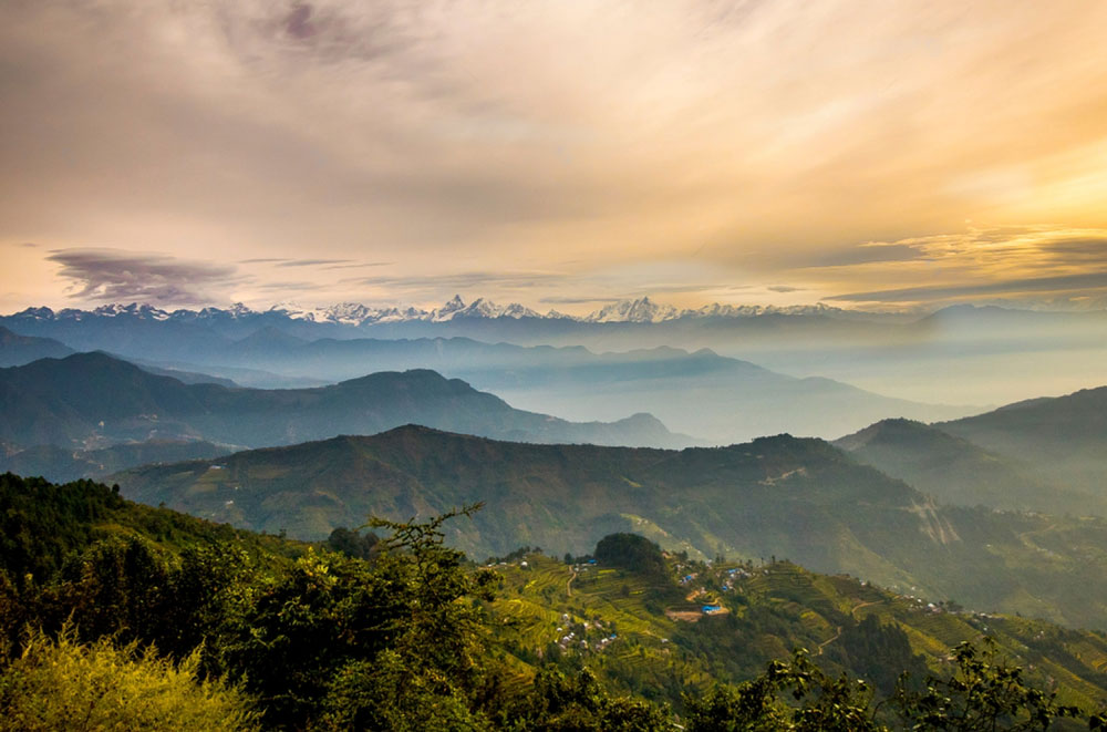
Chisapani is one of the best short treks for travellers who want a proper mountain experience close to Kathmandu. The trail starts at Sundarijal, around an hour's drive from central Kathmandu. From Sundarijal, the route enters Shivapuri National Park and climbs through forest. The first part is shaded and steep, with long stone staircases beside streams and dense woodland.
As you climb higher, the landscape changes. Forest gives way to small settlements, farmland, and open ridgelines. Chisapani sits on one of these ridges, where the landscape opens towards the northern hills.
On clear mornings, the Himalayan range appears beyond the nearer hills. What makes Chisapani particularly useful is its distance from Kathmandu. You can leave the city after breakfast, spend the afternoon walking, and still reach a mountain village by evening.
A Simple And Easy Two-Day Chisapani Route
Day 1: Kathmandu → Sundarijal → Chisapani
The trek starts with a drive from Kathmandu to Sundarijal.
From there, the trail climbs into Shivapuri National Park. The first section has a steady uphill climb with many stone steps. The forest provides shade during much of the morning.
Further up, the trail passes small settlements and open farmland. The final approach to Chisapani becomes more open, with wider views across the surrounding hills.
After around four to five hours of walking, you reach Chisapani. Spend the evening at a local lodge and enjoy the quiet mountain setting.
Day 2: Chisapani → Sundarijal → Kathmandu
Start early if the weather is clear. The morning light can reveal the Himalayan range beyond the hills.
After breakfast, begin the descent towards Sundarijal. The return takes you through forest and back down the stone steps.
From Sundarijal, drive back to Kathmandu. The shorter second day leaves time for lunch and a relaxed afternoon in the city.
Practical Planning Note
The best way to approach Chisapani is to treat it as a short trek, not a rushed day trip. Leave Kathmandu early so the drive to Sundarijal does not eat into your walking time. The uphill section is steady, so a comfortable pace works better than trying to walk quickly. Keep water and a few light snacks in your daypack.
Chisapani is cooler than Kathmandu, especially after sunset and before sunrise. A warm layer is useful even during the warmer months.
During the monsoon, wet steps and muddy sections can slow the walk considerably. Leeches can also appear on damp forest sections after rainfall. Long trousers and proper walking shoes are useful during this period. It is also worth checking your shoes and socks after walking through wet vegetation.
Who Should Choose Chisapani?
Chisapani suits travellers who want more than a short day hike. It is a good first overnight trek for reasonably active travellers. You do not need previous trekking experience.
Families with older children can consider it if everyone is comfortable with several hours of uphill walking. It also suits travellers preparing for longer treks in Nepal.
Most operators run this as a day hike. We offer it as an overnight. The difference is profound. Discover the Chisapani overnight experience or explore the full Sundarijal-Chisapani-Nagarkot trek.
Shivapuri National Park: The Forest Above Kathmandu
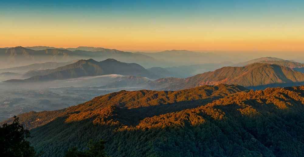
Shivapuri Nagarjun National Park covers 159 square kilometres across the northern hills of Kathmandu Valley. Shivapuri Peak reaches 2,732 metres. For trekking near Kathmandu, Shivapuri offers a different experience from Nagarkot and Dhulikhel. The route is mainly about forest, wildlife, streams, religious sites, and higher ridges.
How Does the Hike Work?
A common starting point is Budhanilkantha, about 11 kilometres from central Kathmandu. From Budhanilkantha, the trail climbs into the park through dense forest. The route can be shortened or extended depending on your time and fitness.
For a shorter hike, the trail around Nagi Gumba is a practical option.
For a longer day, the route can continue through Mulabaari and Deurali towards Bagdwar and Shivapuri Peak.
Another route starts from Panimuhan and climbs towards Bagdwar and Shivapuri Peak. Most day hikes take around four to six hours, depending on the route, walking pace, and stops. The climb becomes more demanding as you approach the higher ridges. The Shivapuri Peak route is best suited to travellers comfortable with several hours of uphill walking.
What Will You Actually Walk Through?
The forest changes as you gain elevation. The lower southern slopes contain pine and Schima-Castanopsis forest. Streams and shaded gullies support denser vegetation.
Higher sections contain oak and rhododendron forests. Rhododendrons flower in spring, while the upper forest becomes cooler and more open. The trail also passes small streams, stone steps, forest clearings, and sections of open ridge.
Wildlife is another reason to choose Shivapuri.
The park supports mammals including barking deer, wild boar, langur, rhesus macaques, leopard, and Himalayan black bear. Larger mammals are rarely seen during normal daytime hikes.
Birdwatching is particularly strong here. A 2024 research checklist recorded 396 bird species in Shivapuri Nagarjun National Park. The list includes 42 nationally threatened species and eight globally threatened species. It also records the spiny babbler, Nepal's only endemic bird. Other recorded birds include Kalij pheasant, hill partridge, Himalayan griffon, flycatchers, eagles, and vultures.
You are more likely to hear birds than see larger wildlife during a normal hike.
As the trail reaches higher ridges, the forest becomes more open. Clear weather can reveal Kathmandu Valley to the south and Himalayan peaks towards the north.
Who Is Shivapuri Suitable For?
Shivapuri suits travellers who prefer forest trails and nature over viewpoints and open farmland. The Nagi Gumba area works well for a shorter hike. Bagdwar and Shivapuri Peak require more stamina because of the sustained uphill sections. You should be comfortable walking on stone steps, uneven forest trails, and steep sections.
Shivapuri also works well for travellers interested in birdwatching, forests, and local religious sites.
If you prefer Kakani hiking, Jamacho peak hiking, and custom Shivapuri routes are hikers' favourite treks in Kathmandu.
What Makes Shivapuri Different?
Shivapuri is also an important watershed for Kathmandu Valley. Bagdwar is associated with the source of the Bagmati River. Bishnudwar is associated with the Bishnumati River.
Both areas are important pilgrimage sites.
Nagi Gumba is an active Buddhist nunnery within the forest. Jamacho and Tarebhir are among the other Hindu and Buddhist religious sites found in the park. The Department of National Parks and Wildlife Conservation also identifies Bagdwar, Jamacho, Bishnudwar, Tarebhir, and Nagi Gumba as important religious sites.
This gives the hike a clear progression. You start near Kathmandu's urban edge, climb through protected forest, and pass religious sites and streams. Later, reach higher mountain ridges.
Champadevi and Phulchowki: Higher Hill Hikes
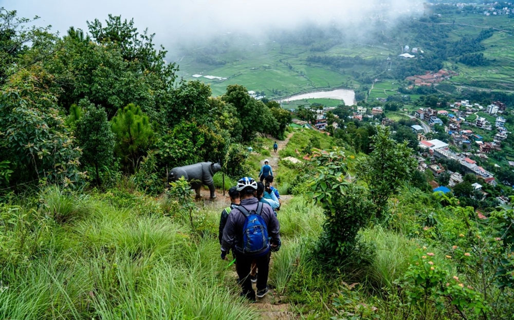
Champadevi and Phulchowki are two of the higher day hikes around Kathmandu Valley. Both involve a steady climb, but the walking experience is quite different.
Champadevi takes you from the Hattiban forest towards an open southern ridge, with the summit and valley views arriving relatively early in the day. Phulchowki is a longer ascent from Godawari. The trail stays in the forest for most of the climb, and the changing vegetation is one of the main reasons to walk it.
Champadevi: Hattiban Forest to the Southern Ridge
Champadevi reaches 2,278 metres on the southern rim of Kathmandu Valley. The usual route starts at Hattiban, above Pharping. From central Kathmandu, drive towards Pharping and continue uphill to Hattiban. The journey normally takes around 45 to 60 minutes, depending on traffic.
The character of the walk changes quite clearly as you climb. You begin in the Hattiban forest, where the trail is enclosed by trees, and the city quickly disappears behind you. The first section is a steady uphill walk through pine and mixed forest. There are no major viewpoints at the beginning, so the focus is on gaining height.
After about an hour and a half, the trail continues towards the ridge. The forest becomes less enclosed, and the surroundings start to open. By the time you reach the upper ridge, the walk feels very different from the first section. You can look back towards the Kathmandu Valley and across the southern hills.
The final approach leads to the Champadevi shrine, with prayer flags marking the summit area. On a clear day, the northern Himalayan ranges can be seen beyond the valley.
The standard route returns to Hattiban by the same trail.
Route: Kathmandu → Pharping → Hattiban → forest trail → Champadevi ridge → Champadevi shrine → Hattiban → Kathmandu
This version takes around three to four hours of walking.
If you want to make it a longer day, continue beyond the summit and descend towards Machchhe Gaun. This gives you a point-to-point walk rather than repeating the same forest trail.
Longer route: Kathmandu → Pharping → Hattiban → Champadevi → ridge trail → Machchhe Gaun → Kathmandu
The longer version generally takes around five to six hours. The appeal of this route is the transition from enclosed forest to an open ridge. You spend the first part of the hike climbing through woodland and the later section walking with much wider views.
It also gives you easy access to the cultural landscape around Pharping, where Buddhist and Hindu sites are spread across the southern hills.
Phulchowki: The Long Forest Ascent from Godawari
Phulchowki rises to around 2,760 metres, making it the highest hill around Kathmandu Valley. The standard route begins at Godawari, around 45 to 60 minutes from central Kathmandu by road. Unlike Champadevi, this hike does not reveal its main landscape early. The route begins around the Godawari area and moves into the forest. The lower section is greener and warmer, with subtropical vegetation around the lower slopes.
Then the climbing starts in earnest. The trail continues upwards through forest, using a mixture of stone steps and narrower woodland paths. There are several steeper sections, but the main challenge is the length of the ascent. You keep gaining elevation for hours.
As you climb, the vegetation changes with the altitude. The warmer lower forest gradually gives way to oak, rhododendron, and other higher-elevation vegetation. This makes Phulchowki feel more like a mountain climb than a simple valley day hike.
In spring, the rhododendrons add another feature to the route. At other times of year, the forest itself is the main attraction. The area is also important for birdwatching. Different elevations provide habitat for a wide range of birds, along with butterflies and other forest wildlife.
Eventually, the forest begins to thin as you approach the summit. At around 2,760 metres, you reach the Phulchowki summit area, where a small temple stands near the open ridge. The summit is the reward for the long ascent rather than the beginning of the experience.
On clear days, you can look across Kathmandu Valley and towards the surrounding Himalayan ranges. The normal route then returns along the same trail to Godawari.
Route: Kathmandu → Godawari → lower forest → upper forest → Phulchowki summit → same forest trail → Godawari → Kathmandu
The full return walk is roughly 18 kilometres and usually takes around six to eight hours, depending on pace and trail conditions. The defining feature of Phulchowki is the climb itself. You start in the warmer lower forest and gradually move into cooler, higher-elevation woodland before reaching the summit.
It suits travellers who enjoy a long day on foot and want more than a short viewpoint hike.
How the Two Routes Differ
Champadevi gives you a shorter climb followed by an open ridge. The route becomes more scenic as you gain height, and you can extend the walk towards Machchhe Gaun.
Phulchowki is a sustained forest ascent. The main interest comes from the changing vegetation, birdlife, and the sense of gradually climbing from Godawari to the highest hill around the valley.
If you want ridge walking and valley views, choose Champadevi.
If you want a longer forest climb and higher elevation, choose Phulchowki.
Best Multi-Day Treks Near Kathmandu
You do not have to travel deep into Nepal to enjoy a multi-day trek. Some of the best trekking routes start just outside Kathmandu and can be reached by a short drive from the city.
Within a few hours of Kathmandu, you can walk through forests, villages, mountain valleys and high Himalayan landscapes. Sundarijal, Chisapani and Nagarkot are the closest options, while Langtang and Gosaikunda take you higher into the mountains without requiring a long journey to the trailhead.
This makes trekking near Kathmandu a good choice when you want more than a day hike but do not want to spend a full day travelling before the trek begins.
Sundarijal-Chisapani- Nagarkot Trek: A Two-Day Trek Close to Kathmandu
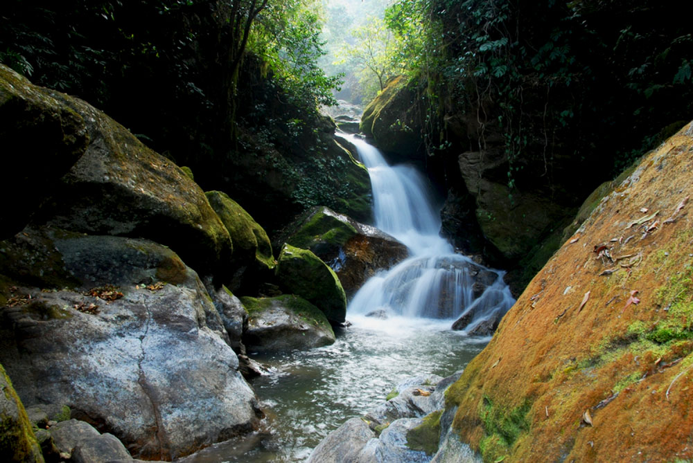
The Sundarijal–Chisapani–Nagarkot route is one of the most accessible ways to experience an overnight trek close to Kathmandu. The trail begins on the northern edge of Kathmandu Valley, climbs through the forested hills of Shivapuri Nagarjun National Park, and continues through villages, farmland and open ridges towards Nagarkot.
The route combines several different landscapes within a short distance of the city. The lower section is shaded and forested, while the higher sections around Chisapani and Nagarkot become more open, with views across the surrounding hills and, on clear days, towards the Himalayan range.
How Does the Route Work?
The trek normally starts at Sundarijal, around 15 kilometres northeast of central Kathmandu. From here, the trail climbs through Shivapuri Nagarjun National Park towards Chisapani before continuing east through rural hills and settlements to Nagarkot.
The first section is the strongest uphill part of the trek, with stone steps, forest paths and streams. Beyond the national park, the landscape gradually opens into farmland and villages around Chisapani. From Chisapani, the trail crosses a mixture of forest, farmland, village paths and some local roads before reaching Nagarkot.
Although the route can be completed in two days, allowing three days and two nights gives a more comfortable pace and time to enjoy both Chisapani and Nagarkot rather than treating them simply as overnight stops.
What Will You Actually Walk Through?
The character of the route changes as you move away from Kathmandu. The walk from Sundarijal is mainly through protected forest, with streams and shaded sections of trail. Higher up, the forest gives way to farmland, terraces and small settlements around Chisapani.
The trail between Chisapani and Nagarkot is more open and varied. You pass through rural communities, patches of woodland and cultivated hillsides before reaching the ridge around Nagarkot.
Nagarkot sits at around 2,175 metres and is known for its wider Himalayan and hill views. On clear days, the landscape opens towards the surrounding valleys and mountains.
What Makes This Route Different?
The first part of the trek passes through Shivapuri Nagarjun National Park, one of the major protected forest areas around Kathmandu Valley. Sundarijal is also an important watershed area, with streams descending from the Shivapuri hills towards the valley.
Beyond the protected forest, the route becomes more rural. The contrast between forest, streams, farmland, villages and open ridges is one of the main reasons this route works well as a short introduction to trekking in Nepal.
Best Itinerary for Sundarijal Chisapani Nagarkot
Day 1: Kathmandu → Sundarijal → Chisapani
A short drive from Kathmandu takes you to Sundarijal, where the walking begins. The trail enters Shivapuri Nagarjun National Park and climbs through forest, following stone steps and sections of trail alongside streams.
As you gain elevation, the forest gradually gives way to farmland and small settlements. The walk continues uphill towards Chisapani, at around 2,300 metres. Chisapani is a small hill settlement with simple local lodges and guesthouses.
Overnight: Chisapani
Walking: Around 4–5 hours, depending on pace and stops
Day 2: Chisapani → Nagarkot
The second day follows the hills east from Chisapani towards Nagarkot. The trail is less continuously uphill than the first day, with a mixture of forest, farmland, village paths and some local roads.
The route passes through rural settlements and cultivated hillsides before gradually reaching the more open ridge around Nagarkot. The afternoon can be kept relaxed, with time to explore the area and, weather permitting, enjoy the mountain views.
Overnight: Nagarkot
Walking: Around 5–6 hours
Day 3: Nagarkot → Kathmandu
Start the morning with sunrise over the Himalayan range from Nagarkot, weather permitting. After breakfast, you have two options.
Option 1: Enjoy the morning in Nagarkot and return to Kathmandu by private vehicle.
Option 2: Enjoy the sunrise in Nagarkot, then hike towards Changu Narayan before returning to Kathmandu by private vehicle.
The Changu Narayan option adds several hours of walking and finishes near one of the Kathmandu Valley's important historic temples.
Who Is This Trek Suitable For?
The route is generally easy to moderate, with the main physical challenge being the sustained climb from Sundarijal to Chisapani. The highest point is around 2,300 metres, so altitude is not normally the main concern.
It works well for first-time trekkers, active families and travellers who want a genuine mountain walking experience without travelling far from Kathmandu.
Practical Information
Because the first section enters Shivapuri Nagarjun National Park, a park entry fee applies. Local trekking lodges and guesthouses are available in both Chisapani and Nagarkot. A local guide is useful for navigating the trail variations between Chisapani and Nagarkot and for adding context about the forest, water sources and farming communities along the route.
The clearer and drier months generally provide the best walking conditions and Himalayan visibility. The route can also be walked during other seasons with appropriate preparation.
Book the Sundarijal-Chisapani-Nagarkot 3-Day Trek
Langtang Valley Trek: A Himalayan Trek Close to Kathmandu
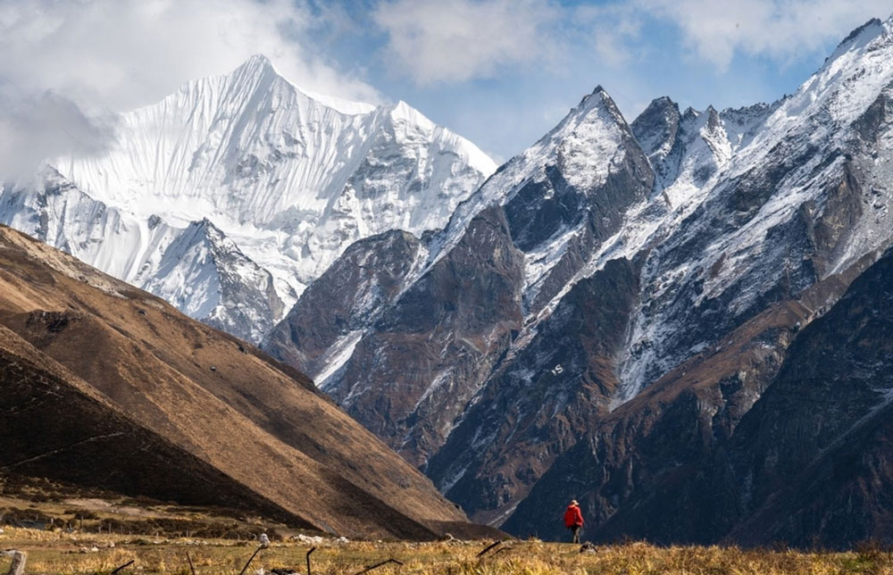
Langtang is one of the closest major trekking areas to Kathmandu. The trek starts with a drive north to Syabrubesi, and from there the trail goes deep into the Langtang Valley.
Syabrubesi is about 1,420 metres high. The drive from Kathmandu usually takes around 6 to 8 hours, depending on road conditions.
You can leave Kathmandu in the morning, reach Syabrubesi the same day and start walking the next morning. Within a few days, the trail takes you from green forests and river valleys to the high mountain landscape around Kyanjin Gompa, at about 3,800 metres.
Route: Kathmandu → Syabrubesi → Lama Hotel → Langtang Village → Kyanjin Gompa → Kyanjin Ri or Tserko Ri → Lama Hotel → Syabrubesi → Kathmandu
Allow about 7 to 9 days round trip from Kathmandu.
How Does the Langtang Route Work?
The trek starts at Syabrubesi and follows the Langtang Khola into the valley. The main overnight stops are Lama Hotel, Langtang Village and Kyanjin Gompa.
The trail climbs higher as you move up the valley. The forest becomes thinner, the land becomes more open, and the mountain views become stronger.
Kyanjin Gompa, at about 3,800 metres, is the highest main stop. Most trekkers spend an extra night here to explore the area or climb Kyanjin Ri or Tserko Ri.
After Kyanjin, you return through the same valley to Syabrubesi before driving back to Kathmandu.
What Will You Actually Walk Through?
The lower part of the trek passes through forest, farmland and mountain villages. You walk beside the Langtang Khola and cross several suspension bridges. The trail has a mix of dirt paths, rocks and stone steps. Some parts are easy, while other sections are steep or uneven.
As you climb higher, the forest becomes thinner. You start to see open mountain slopes, yak grazing areas and rocky land. The trail passes through villages with stone houses, mani walls, chortens, prayer flags and Buddhist shrines. The area has a strong Tamang and Tibetan Buddhist culture.
At Kyanjin, the landscape becomes more open, and the mountain views become much bigger. Langtang Lirung, at 7,245 metres, is one of the main peaks you can see.
Langtang Village was badly damaged by the 2015 earthquake and has since been rebuilt. Today, you can see how local people have rebuilt their homes and tourism businesses.
Langtang Valley Trek: Seven to Nine Days Itinerary
Day 1: Kathmandu → Syabrubesi
Drive from Kathmandu to Syabrubesi.
Overnight: Syabrubesi
Day 2: Syabrubesi → Lama Hotel
Begin the trek and walk to Lama Hotel.
Overnight: Lama Hotel
Walking: Around 5–6 hours
Day 3: Lama Hotel → Langtang Village
Continue to Langtang Village, with a stop at Ghora Tabela along the way.
Overnight: Langtang Village
Walking: Around 5–6 hours
Day 4: Langtang Village → Kyanjin Gompa
Walk to Kyanjin Gompa, the main settlement in the upper Langtang Valley.
Overnight: Kyanjin Gompa
Walking: Around 4–5 hours
Day 5: Kyanjin Gompa
Explore the Kyanjin area. You can also climb Kyanjin Ri or Tserko Ri if conditions are good.
Overnight: Kyanjin Gompa
Day 6: Kyanjin Gompa → Lama Hotel
Return to Lama Hotel.
Overnight: Lama Hotel
Walking: Around 6–7 hours
Day 7: Lama Hotel → Syabrubesi
Continue back to Syabrubesi.
Overnight: Syabrubesi
Walking: Around 5–6 hours
Day 8: Syabrubesi → Kathmandu
Drive back to Kathmandu.
For shorter walking days, an extra night can be added along the route.
Who Is Langtang Suitable For?
Langtang is a good choice for travellers who want a real Himalayan trek without spending two weeks on the trail.
The trek is moderate to challenging. You walk for several hours each day, with some steep, rocky and uneven sections.
You do not need climbing skills or advanced trekking experience. A steady pace and enough time to adjust to the altitude are important, especially around Kyanjin.
Practical Information
Langtang is inside Langtang National Park, so a park entry permit is required. TIMS requirements also apply to the trekking route.
A local guide helps with navigation, walking pace and understanding the villages, Buddhist sites and local way of life.
Trail conditions change as you climb. Lower sections can be wet and muddy after rain. Higher sections are more open and rocky, with possible snow in winter. Good walking shoes with a strong grip are important for the Langtang trek.
The road to Syabrubesi can be affected by weather and road conditions. The clearer and drier months usually offer better walking conditions and mountain views.
Join the Gosaikunda pilgrimage trek or combine it with Langtang for deeper immersion.
Gosaikunda Trek: The Sacred Alpine Trek
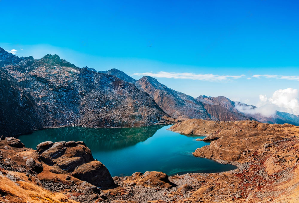
Gosaikunda is one of the highest trekking destinations. You can reach it from Kathmandu without taking a flight. The trek starts at Dhunche, north of Kathmandu, and goes through Langtang National Park to the sacred Gosaikunda Lake at about 4,380 metres.
It is a big change from the city. You can leave Kathmandu by road, start walking the next morning, and reach a high mountain area within a few days. Gosaikunda is also an important Hindu pilgrimage site. During Janai Purnima, thousands of pilgrims travel to the lake.
Direct route: Kathmandu → Dhunche → Sing Gompa → Gosaikunda → Dhunche → Kathmandu
Allow about 5 days from Kathmandu and back for the direct trek.
How Does the Gosaikunda Route Work?
The journey starts with a drive from Kathmandu to Dhunche. The drive takes most of the day, depending on the road.
The walk starts from Dhunche the next morning. The trail climbs through forests and small mountain villages towards Sing Gompa, also called Chandanbari.
From Sing Gompa, the trail gets quieter as you climb higher. There are fewer villages and more open mountain land. The final climb to Gosaikunda is steep in places, and the high altitude makes the walking harder.
What Will You Actually Walk Through?
The lower part of the trek passes through forests, farms and mountain villages. At Sing Gompa, you can see a Buddhist monastery and learn about the area's old cheese-making tradition.
Above Sing Gompa, the forest slowly disappears, and the land becomes more open. You walk through high mountain slopes before reaching the Gosaikunda area.
Gosaikunda is one of several high mountain lakes in the area. The main lake sits at about 4,380 metres.
The lake is sacred to Hindus and is linked with Lord Shiva. During Janai Purnima, pilgrims come here to bathe in the lake. Along the trail, you may see pilgrims, small shrines and prayer flags. Buddhist culture is also part of the journey, especially around Sing Gompa.
You can also continue from Gosaikunda instead of returning to Dhunche. The longer route crosses Lauribina Pass, at about 4,609 metres, and then goes down through Ghopte, Tharepati and Kutumsang before reaching Chisapani and Sundarijal. This longer trek takes about 7 to 9 days and finishes back towards Kathmandu Valley.
Longer route: Kathmandu → Dhunche → Sing Gompa → Gosaikunda → Lauribina Pass → Ghopte → Tharepati → Kutumsang → Chisapani → Sundarijal → Kathmandu
Gosaikunda Trek: Five Days
Day 1: Kathmandu → Dhunche
Drive from Kathmandu to Dhunche, where the trek begins. The drive takes most of the day, depending on road conditions.
Overnight: Dhunche
Day 2: Dhunche → Sing Gompa
Start walking from Dhunche. The trail climbs through forests and mountain villages towards Sing Gompa. You gain height slowly as you walk.
Overnight: Sing Gompa
Walking: Around 5–6 hours
Day 3: Sing Gompa → Gosaikunda
The trail climbs higher, and the forest becomes thinner. The land becomes more open as you get closer to Gosaikunda. The final part is harder because you are walking at high altitude.
Overnight: Gosaikunda
Walking: Around 6–7 hours
Day 4: Gosaikunda → Dhunche
Spend some time around the lake before walking back towards Dhunche. Most of the day is downhill as you return through the mountain and forest areas.
Overnight: Dhunche
Walking: Around 6–7 hours
Day 5: Dhunche → Kathmandu
Drive from Dhunche back to Kathmandu. The journey can take most of the day, so it is good to keep the schedule flexible.
Who Is Gosaikunda Suitable For?
Gosaikunda is a good choice for travellers who want to experience a real Himalayan trek without travelling far from Kathmandu by road.
The direct trek is moderate to challenging. The main challenge is the long uphill walking and the high altitude around the lake. The Lauribina Pass route is harder because it goes even higher and has longer walking days.
You do not need to be an experienced high-altitude trekker, but you should be comfortable walking for several hours each day and give your body enough time to adjust to the altitude.
Practical Information
Gosaikunda is inside Langtang National Park, so a park entry permit is required. TIMS requirements also apply to the trekking route.
A local guide is useful for finding the trail, setting a comfortable walking pace and dealing with the higher altitude. A guide can also explain the local villages, monasteries and religious traditions along the way.
The clearer and drier months usually offer the best walking conditions and mountain views for the Gosaikunda trek.
Experience the Langtang Valley trek with cultural immersion or explore longer Langtang & Gosaikunda combinations.
Trekking Near Kathmandu at a Glance
| Trek / Hike | Time | Highest Point | Best For |
|---|---|---|---|
| Nagarkot | 1 day | ~2,175m | Easy walking, countryside, mountain views |
| Dhulikhel | 1 day | ~1,550m | Villages, farmland, relaxed hiking |
| Shivapuri | 1 day | 2,732m | Forest, birds, longer uphill walking |
| Champadevi | 1 day | 2,278m | Forest trails, uphill hiking, views |
| Phulchowki | 1 day | ~2,760m | Forest, birds, more challenging hiking |
| Chisapani | 2 days | ~2,300m | First overnight trek |
| Gosaikunda | 5–6 days | ~4,380m | Alpine lake, pilgrimage, high-altitude trekking |
| Langtang | 7–9 days | ~3,800m+ | Himalayan trekking, mountain landscapes |
Which Multi-Day Trek Near Kathmandu Fits You?
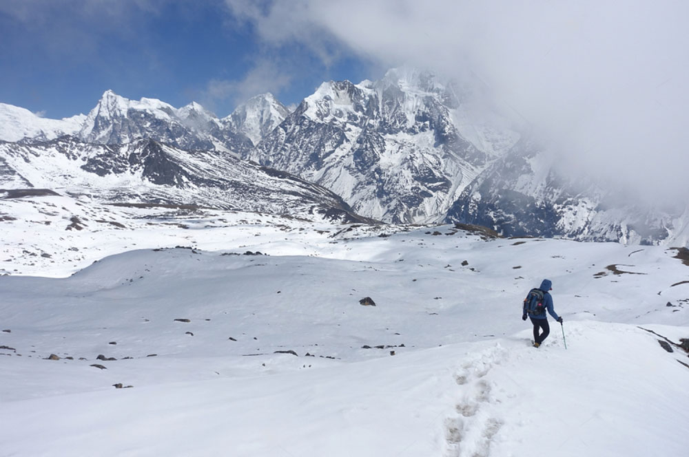
If you have two days, Chisapani and Nagarkot give you forest, villages, farmland, and mountain views without a long road journey.
If you have five to six days, Gosaikunda takes you into much higher mountain terrain and reaches 4,380 metres.
If you have a week or more, Langtang gives you a deeper Himalayan experience with Tamang villages, Kyanjin Gompa, and high mountain views.
The difference is not only the number of days. It is also how high you want to go, how much uphill walking you enjoy, and how much time you want to spend travelling by road.
Talk to us about your Kathmandu Trek.
Best Time to Trek Near Kathmandu
You can trek near Kathmandu all year.
October to November: Best for most routes. Try Langtang, Gosaikunda, Chisapani, Nagarkot, or Dhulikhel.
March to May: Great for Langtang, Chisapani, Shivapuri, and Phulchowki. The forests are green and full of flowers.
December to February: Choose lower routes like Nagarkot, Dhulikhel, Shivapuri, and Champadevi. Higher routes can be very cold.
June to September: Choose shorter hikes like Nagarkot, Dhulikhel, and Shivapuri. Expect rain, muddy trails, and cloudy views.
How We Plan Treks Near Kathmandu
At Himalayan Scenery Treks, planning starts before you arrive in Nepal.
We look at your available time, walking pace, interests, and the experience you want. This helps us choose the right route and prepare the guide.
Before a longer trek, we brief the guide on the itinerary, walking hours, accommodation, road conditions, and your preferences. We also consider whether you prefer a steady pace, photography stops, village visits, or more time to explore.
We keep our groups small. Longer treks usually have around six to ten travellers, while day hikes are often limited to four to six. This makes it easier for the guide to manage the group and adjust the pace when needed.
We also plan transport carefully. Traffic, road conditions, and travel time can affect the walking day, especially for Langtang and Gosaikunda. For shorter hikes such as Shivapuri, Champadevi, and Phulchowki, an early start can give you more time on the trail.
Weather and trail conditions are part of the planning too. Rain, fog, cold, or snow may require changes to the schedule or route. On higher treks, we also pay attention to how travellers are adjusting to the altitude.
The aim is simple: choose a route that suits you, keep the pace comfortable, and leave enough time to enjoy the experience.
[Plan Your Kathmandu Trek With HST →]
What to Pack for Trekking Near Kathmandu
What you need depends on the route and season. Day hikes need only a light daypack, while Langtang and Gosaikunda require warmer clothing and proper trekking gear.
For day hikes:
Water bottle
Snacks
Comfortable walking shoes
Light jacket
Sunscreen and sunglasses
Rain jacket during the monsoon
For overnight treks:
Warm layers
Change of clothes
Extra socks
Toiletries
Headlamp
For Langtang and Gosaikunda:
Thermal layers
Warm jacket
Gloves and warm hat
Waterproof jacket
Proper trekking shoes
Sunscreen and sunglasses
Sleeping bag for colder routes
Safety and Altitude While Trekking Near Kathmandu
Most hikes around Kathmandu are straightforward when the route matches your fitness, and the weather is suitable.
The situation changes as you move into higher areas such as Langtang and Gosaikunda. This is where having an experienced guide can make the trek much easier to manage.
Lower-Altitude Hikes
Nagarkot, Dhulikhel, Chisapani, Shivapuri, Champadevi, and Phulchowki do not normally involve major altitude concerns.
The more common issues are steep sections, uneven trails, slippery steps, heat, rain, or simply walking farther than expected.
A local guide helps with these practical details. They know where the trail becomes steep, where to stop for water, and which route is more suitable when conditions change.
Higher-Altitude Treks
Altitude becomes more important in Langtang and Gosaikunda.
Kyanjin Gompa is around 3,800m, while Gosaikunda is around 4,380m. The Lauribina Pass on the longer Gosaikunda route reaches about 4,609m.
A guide helps manage the pace from the beginning. Rather than trying to cover a fixed distance as quickly as possible, the walking day can be adjusted around how you are feeling.
They also know the normal progression of the route and can recognise when a traveller needs more rest or a slower day.
Why a Guide Helps
A guide is useful long before there is a problem.
They know the trail, set a comfortable pace, choose good places for breaks, and communicate with local people and lodge owners. If weather changes, the guide can suggest a safer route or adjust the day's plan.
On higher trails, they also keep an eye on altitude symptoms. If you develop a headache, unusual tiredness, dizziness, nausea, or difficulty walking normally. Tell your guide immediately.
The guide can then help decide whether you should rest, slow down, stay at the same altitude, or change the plan. This is one reason we consider the guide part of the planning process, rather than simply someone who walks in front of the group.
Weather and Trail Conditions
Weather can change quickly in the hills. Rain can make stone steps and forest trails slippery around Kathmandu. Higher trails can become much colder, snowy, or difficult to cross depending on the season.
Our guides keep track of conditions during the trek and communicate with our operations team when a decision needs to be made. Road conditions also matter on routes such as Langtang and Gosaikunda. The journey to the trailhead is part of the overall plan.
Permits and Local Requirements
Some trekking areas require permits and other documentation. Langtang National Park requires an entry permit. Trekking rules also require the right guide and TIMS documents.
We check all the rules before your trek and arrange the permits and documents for you.
Talk to us for more practical info if your trek is near Kathmandu.
FAQs About Trekking Near Kathmandu
What are the best hiking trails near Kathmandu for beginners?
For a first hike, Nagarkot, Dhulikhel, and Shivapuri are good places to start. Nagarkot and Dhulikhel have easy walks through the countryside. Shivapuri has more forest and some long uphill walks.
If you want to try an overnight trek for the first time, Chisapani is a good choice. The walk from Sundarijal takes about four to five hours. You can enjoy a real trek without going too high into the mountains.
What are the best short day hikes from Kathmandu?
It depends on how much walking you want. Nagarkot is good for a relaxed countryside walk and mountain views. Dhulikhel combines rural trails with views across the surrounding hills. Shivapuri is better for forest, birds, and a longer uphill walk.
For a more physical day, choose Champadevi or Phulchowki. Phulchowki involves the longest sustained climb and reaches around 2,760m.
Which trek near Kathmandu has the best mountain views?
There is no single answer because visibility depends heavily on weather and season. For an easy mountain-view hike, Nagarkot and Dhulikhel are practical choices. Chisapani offers a closer mountain setting after an overnight stay.
If you want to walk deeper into the Himalayas, Langtang is the better choice. The trail eventually reaches Kyanjin Gompa at around 3,800m, with high peaks surrounding the valley.
Can I trek near Kathmandu without previous trekking experience?
Yes. You do not need previous trekking experience for most of the shorter routes. Nagarkot, Dhulikhel, Shivapuri, Champadevi, and Phulchowki can suit first-time hikers who are comfortable walking for several hours.
Chisapani is a good first overnight trek. The longer Langtang and Gosaikunda routes need more preparation because of longer walking days and higher altitude. The important part is choosing a route that matches your normal activity level.
Do I need a guide for trekking near Kathmandu?
For shorter hikes, a guide makes the experience easier and more flexible. They know the trail variations, local conditions, places to stop, and alternative routes if weather changes.
A guide is very helpful on Langtang and Gosaikunda. These treks have higher altitudes, longer walking days, and changing weather.
Under Nepal’s current trekking rules, foreign trekkers in many areas must travel with a licensed guide from a registered trekking agency.
How many days do I need for a trek near Kathmandu?
You can start with a few hours or spend more than a week in the mountains.
Nagarkot, Dhulikhel, Shivapuri, Champadevi, and Phulchowki can be done as day hikes.
Chisapani and Nagarkot work well as a two-day, one-night trek.
A direct Gosaikunda itinerary usually takes around five to six days from Kathmandu. Langtang generally needs around seven to nine days from Kathmandu and back.
The road journey is included when we calculate the total time.
Can I arrange private transport to the trekking trailhead?
Yes. Private transport is particularly useful for day hikes because it lets you choose the departure time and return directly to Kathmandu.
For example, you can arrange a private vehicle to Sundarijal for Chisapani, Godawari for Phulchowki, Hattiban for Champadevi, or Budhanilkantha for Shivapuri.
For Langtang and Gosaikunda, private road transport can take you from Kathmandu to the relevant trailhead. This also gives more control over departure time and stops along the journey.
How do I book a trek near Kathmandu with HST?
Tell us your travel dates, number of people, number of days, and what kind of trek you want.
You do not need to know the exact trek before you contact us. If you have two days and want an easy first trek, we can suggest Chisapani or another good option.
For longer treks, we will look at your walking experience, pace, travel season, and how comfortable you are with high altitude.
Once you choose the trek, we can arrange your guide, private transport, permits, accommodation, and other trekking needs.
[Plan Your Trek Near Kathmandu With HST →]
Ready to Trek Near Kathmandu?
You do not need to travel far from Kathmandu to experience Nepal on foot.
Whether you have a few hours for Shivapuri, a night in Chisapani, or a week in Langtang, the right route depends on your time, walking pace, season, and interests.
At Himalayan Scenery Treks, we plan the practical details around you. That includes the route, guide, transport, accommodation, permits, and daily walking schedule.
If you are not sure which trek fits your time in Nepal, tell us how many days you have and what kind of experience you want. We can help you choose a route that makes sense.
[Schedule a Trekking Conversation] [Customise Your Trek][Email Us Directly]